


Jasserie - saut du Gier

alinetpierre
User
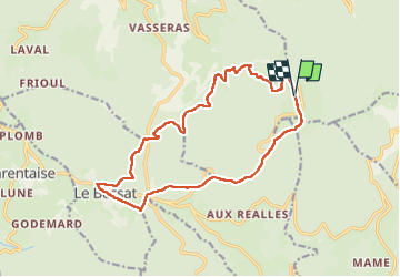

Length
17.2 km

Max alt
1424 m

Uphill gradient
776 m
Km-Effort
28 km

Min alt
812 m

Downhill gradient
777 m
Boucle
Yes
Creation date :
2025-07-13 06:06:52.358
Updated on :
2025-07-13 13:25:19.094
7h17
Difficulty : Difficult

FREE GPS app for hiking
 SityTrail
IGN / Geographical institutes
SityTrail Plus
The world is yours!
About
Trail Walking of 17.2 km to be discovered at Auvergne-Rhône-Alpes, Loire, La Valla-en-Gier. This trail is proposed by alinetpierre.
Positioning
Country:
France
Region :
Auvergne-Rhône-Alpes
Department/Province :
Loire
Municipality :
La Valla-en-Gier
Location:
Unknown
Start:(Dec)
Start:(UTM)
623188 ; 5027497 (31T) N.
Comments